Log in
All resources
Create a design
5,876 Free Artworks of Image Map
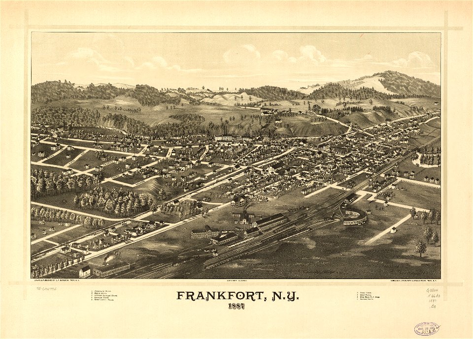
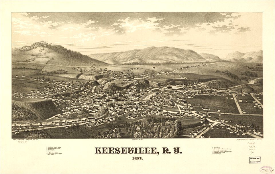
maps in the library of congress
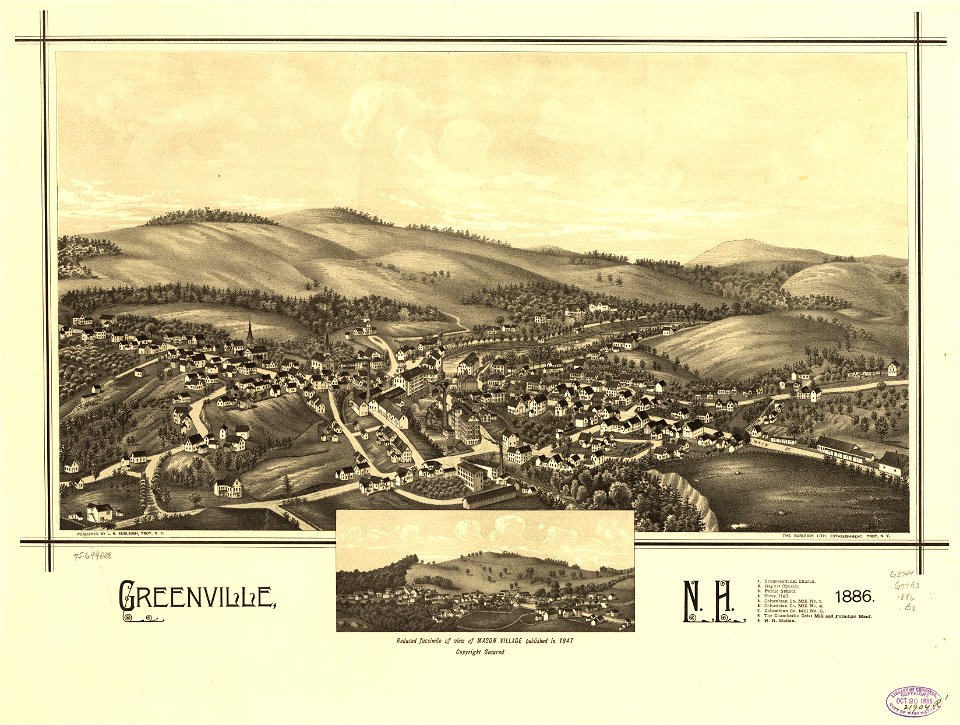
town maps by l. r. burleigh
l. r. burleigh
bird's eye view maps of new york (state)
1887 maps of new york (state)
maps from the earth and its inhabitants, vol. vii
description de l'universe
alain manesson mallet
maps from the earth and its inhabitants, vol. vi
maps from the earth and its inhabitants, vol. iv
tinted lithographs in the british museum
victorian architecture
description de l'universe
1680s maps of england
maps of impact craters in thaumasia quadrangle
porter (martian crater)
maps of impact craters on mars
sharonov (martian crater)
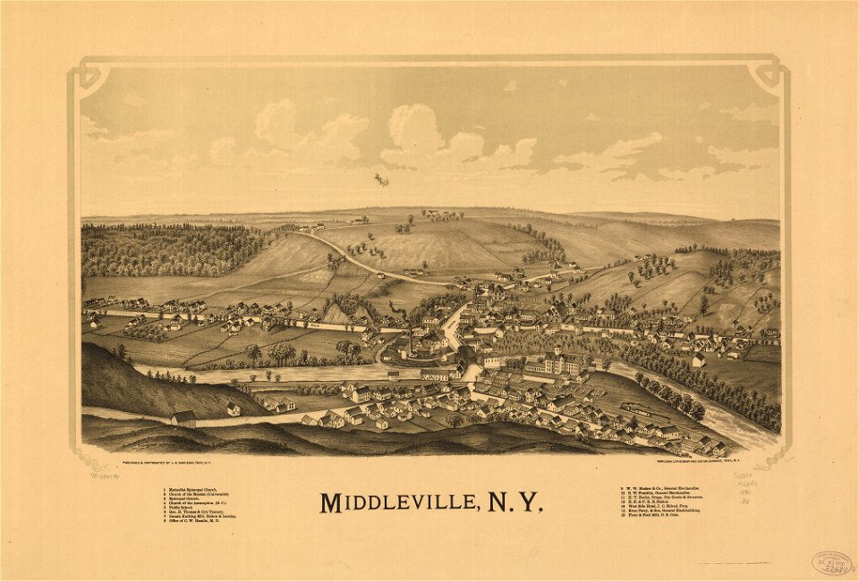
maps in the library of congress
1887 maps of new york (state)
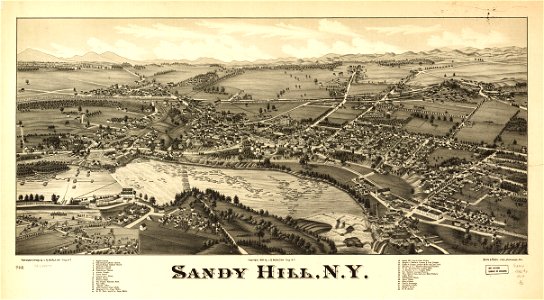
maps in the library of congress
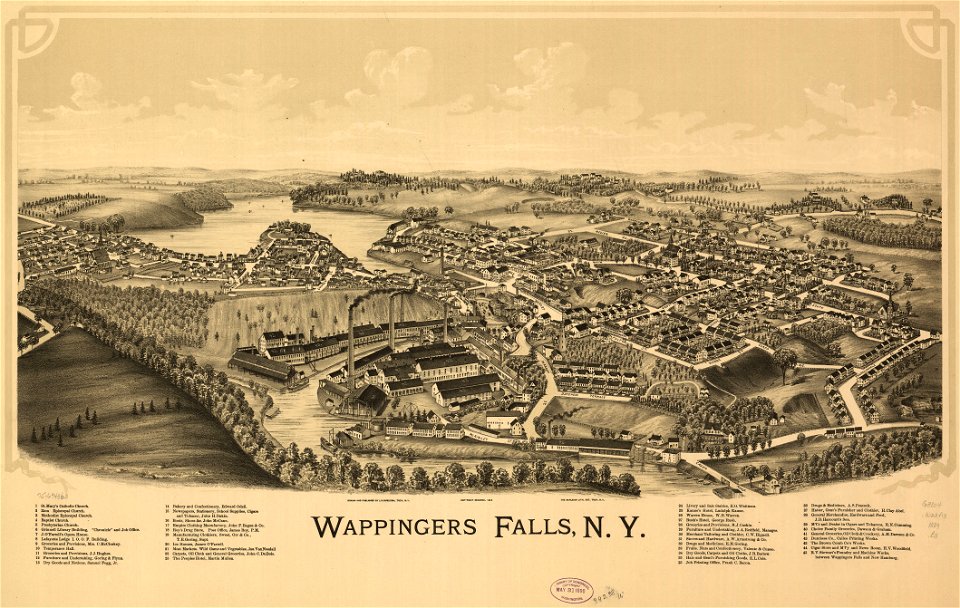
1887 maps of new york (state)
maps in the library of congress
1890 maps of new york (state)
maps in the library of congress
1884 maps of new york (state)
maps in the library of congress
1890 maps of new york (state)
maps in the library of congress
1887 maps of new york (state)
maps in the library of congress
1889 maps of new york (state)
maps in the library of congress
1890 maps of new york (state)
petit atlas pittoresque des 48 quartiers de la ville de paris, david rumsey historical map collection
maps of paris from the david rumsey historical map collection
maps of visegrád by braun & hogenberg
johann siebmacher
maps of the cape of good hope
old maps of cape peninsula
maps in the rijksmuseum amsterdam
maps of paris by frans hogenberg
17th-century maps of cape verde
art of cape verde
maps in the library of congress
maps of adams county, illinois
historical images of havana
old maps of havana
gemeente atlas van nederland - utrecht
old maps of amersfoort
maps in the library of congress
1877 maps of the united states
18th-century maps of new orleans
maps in the library of congress
saigon during the french colonial period
citadel of saigon
maps in the library of congress
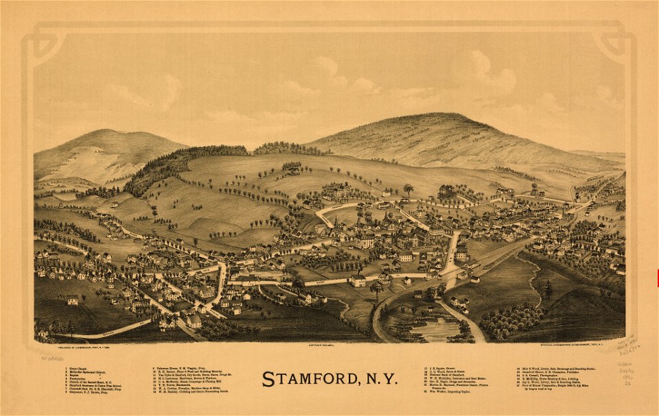
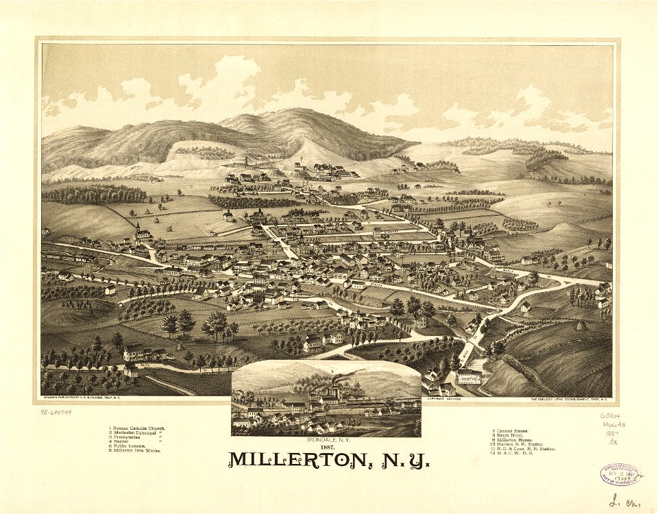
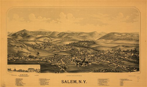
millerton, new york
historical images of boulevard des capucines
rue basse-du-rempart (paris)
images of venice by jacopo de' barbari in the cleveland museum of art
details of images of venice by jacopo de' barbari
picturesque burma, past and present (1897)
1890s maps showing history
lithographs of paris
floor plans of paris
maps in the library of congress
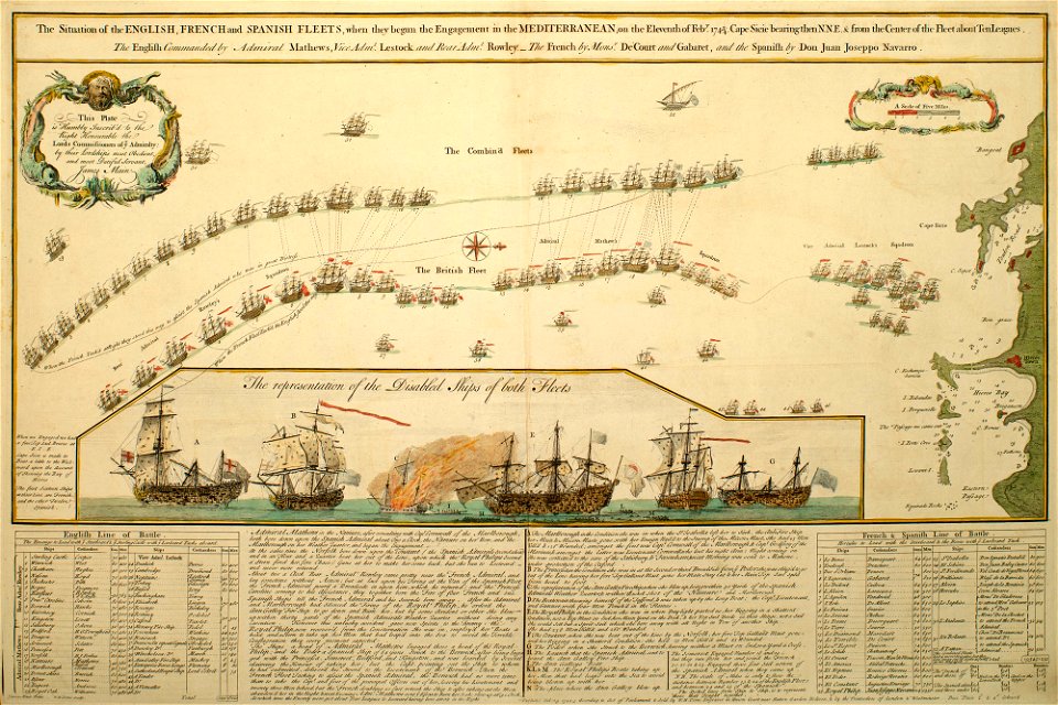
1670 maps
maps in the library of congress
1877 maps of the united states
old and new london, illustrated (1873) by walter thornbury and edward walford - bl 1887 copy
maps from the mechanical curator collection
maps of rivers of equatorial guinea
komo (river)
maps in the library of congress
1758 maps
maps from the earth and its inhabitants, vol. vi
population density maps of russia
maps from the earth and its inhabitants, vol. vii
population density maps of china
maps from the earth and its inhabitants, vol. xviii
maps of the conquest of peru
maps from the earth and its inhabitants, vol. vi
ferdinand von richthofen
maps from the earth and its inhabitants, vol. xvi
guillaume le testu
maps from the earth and its inhabitants, vol. iv
topographic maps of scotland
maps from the earth and its inhabitants, vol. vii
dungan revolt
maps in the library of congress
1875 maps of california
maps of archaeological sites in italy
storia degli antichi popoli italiani
maps of archaeological sites in italy
storia degli antichi popoli italiani
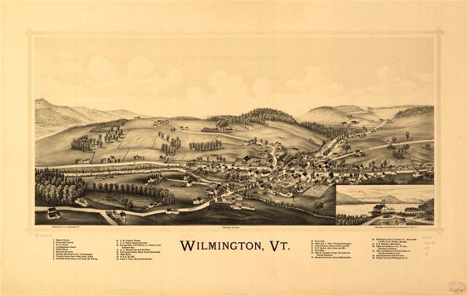
maps in the library of congress
1891 maps of vermont
book pages from france
découvertes gallimard
maps from the earth and its inhabitants, vol. iv
ecclesiastical maps
historical images of la crosse, wisconsin
maps in the library of congress
ross township, butler county, ohio
hill forts in the united states
curt teich postcard archives
map postcards
maps showing history of indigenous peoples of north america
serpent mound
maps in the library of congress
1889 maps of new york (state)
maps in the library of congress
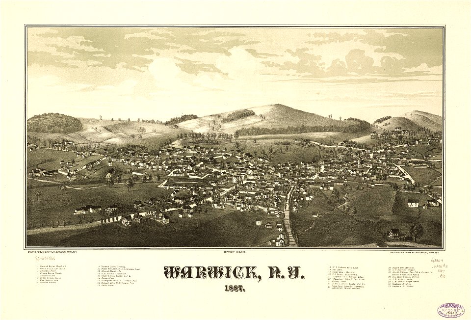
1887 maps of new york (state)
maps in the library of congress
1841 maps of massachusetts
maps in the library of congress
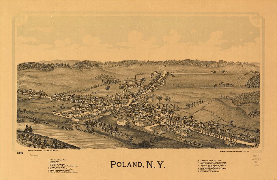
1885 maps of new york (state)
maps from the earth and its inhabitants, vol. vii
charles eugène perron
maps from the earth and its inhabitants, vol. iv
chorley, england
maps by thomas nast
1872 maps of texas
maps in the library of congress
1960 maps of africa
maps in the library of congress
1880 maps
victor levasseur - maps of the world
old maps of north america
prints in the royal collection of the united kingdom
william henry toms
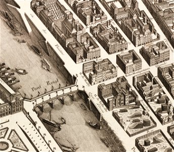
turgot map of paris – derivative files
musketeers of the guard
maps in the library of congress
1852 maps of massachusetts
maps in the library of congress
1830s maps of china
australia (1873) by booth
1870s maps of australia
german renaissance
old maps of venice
topographia austriacarum (merian)
baroque
maps in the library of congress
1670s maps of brazil
maps from the earth and its inhabitants, vol. vii
maps of the history of beijing
maps in the library of congress
1780s maps of cuba
atlas van der hagen (volume 2)
atlas van der hagen
bibliothèque municipale de reims, rès. g 152
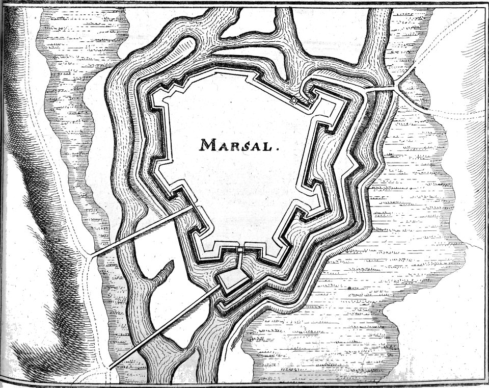
old maps of marsal
files based of data provided by the czech office for surveying and cadastre
kačina
maps from university of amsterdam special collections
atlas der neederlanden
yokohama foreign settlement
history of yokohama
maps from the mechanical curator collection
realism
old maps of kea (cyclades)
description de l'universe
maps in the library of congress
1886 maps of new hampshire
maps from the earth and its inhabitants, vol. vii
charles eugène perron
maps from the earth and its inhabitants, vol. vi
old maps of kyrgyzstan
maps from the earth and its inhabitants, vol. iv
falkirk
maps from the earth and its inhabitants, vol. vi
old maps of kyrgyzstan
maps from the earth and its inhabitants, vol. xvii
topographic maps of new york (state)
turgot map of paris, david rumsey historical map collection – derivative files
historical images of place des vosges
turgot map of paris, david rumsey historical map collection – derivative files
historical images of église saint-sulpice
maps in the library of congress
1780s maps of the caribbean
historical images of håkonshallen
bergenhus festning in art
maps from the earth and its inhabitants, vol. x
1910s maps of somaliland
maps from the earth and its inhabitants, vol. xiii
somaliland
maps in the library of congress
old maps of connecticut
bibliothèque municipale de reims, rès. g 153
historical images of montélimar
17th-century maps of central america
description de l'universe
curt teich postcard archives
postcards of oklahoma
maps in the library of congress
1747 maps of new jersey
18th-century maps of morocco
1700s maps of algeria
maps in the library of congress
1763 maps of north america
map of the german empire by louis stanislas d'arcy de la rochette
1780s maps of lithuania
maps in the library of congress
18th-century maps of jamaica
maps from university of amsterdam special collections
atlas der neederlanden
maps in the library of congress
18th-century maps of sumatra
301 - 400 of 5,876
Next page
/ 59